What's New
Bug fix...
Bug fix...
Size:
226 MB
Category:
Navigation
Navigation
OS:
iOS
iOS
Price:
$4.99
$4.99
Compatible:
iPhone iPad
iPhone iPad
Requirements:
Compatible with iPhone
Compatible with iPhone
Version:
1.1.1
1.1.1
Description - MapOut
.
The MapOut is now available for $4.99 for both iPhone and iPad owners.The application is supporting English language. It weighs in at a hefty 226 MB, so make sure you have plenty of free space on your iOS device. The new MapOut app version 1.1.1 has been updated on 2014-11-19. For ensuring consistency with the device you should take into account the following app compatibility information: Compatible with iPhone, iPod touch, and iPad.Requires iOS 4.2 or later.
Bottom Line: For more information about MapOut check developer Valnova`s website : http://www.mapoutapp.com
Bottom Line: For more information about MapOut check developer Valnova`s website : http://www.mapoutapp.com
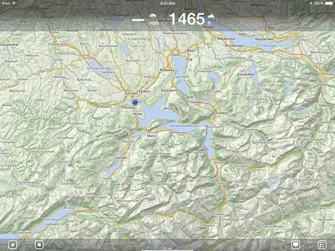
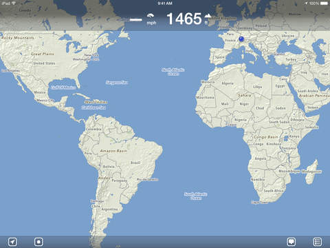
Offline map covering all of Switzerland - for hiking, biking or as city map - Map data from OpenStreetMap.org - No internet connection required - complete map is integrated in App - Topological map (elevation data) of Switzerland - ...
Pretty darn good Some minor trail versus location offset at times but still good Good for finding trails EdgarSonneborg
I was always impressed with the app s ability to draw routes by hand and snap to the road network The recent update introduces a number of improvements and features I felt were either once lacking or are totally unique This is my new favorite app alongside Maps me Update After using the app with the new update I find one thing annoying the stylized arrow is difficult to see I would prefer a triangle shape just like in the app icon If something is wrong with this opinion at least give the users a choice of the standard triangular arrow or the fancy kind Lastly the arrow almost always points in the wrong direction especially when in motion such as riding in a car I m sure this is just a bug that can be fixed Awesome update sort of Ahikanana
Great app that I downloaded because a pro cyclist team director a big team btw was using it in the car It d be amazing if we could add markers for climb categories sprints feed zones basically icons from the Tour de France stage profiles And also track how far those markers and finish are from the current position Map quality is outstanding Great app for cycling Matt3637
I had a number of problems with this at first so I contacted the company They bent over backwards to help and explain and after several exchanges things worked out nicely These folks are highly professional and service oriented so I am happy to herein modify my original review Thank you Michael and Stefan Impressive follow up Beaumont Sweeties
I absolutely love this app but they need some bug fix updates quickly It crashes far too often I like the app enough to deal with these annoying interruptions for now but I hope the fixes will be forthcoming great but MarkTroup
Best map app I have seen for hikers and bikers topological maps allowing quick profiles accurate trail and road data efficient memory use for maps and tracks Efficient offline hiking maps Bear2014Ca
Downloaded this while looking for openstreetmaps compatible apps There are some awkward UI issues like how it doesn t automatically download lower levels without explicitly requesting them or how I can t search for places that I haven t downloaded even when I have cell service It lacks satellite views which is a must for some cell wifi capable outdoor areas Also deleting downloaded data is an all or nothing deal Overall I don t see myself using this very much Difficult to use and missing features chrismendez
I love that it quietly records stuff without needing the display I was out for 2 hours using it on my iPOD touch with the Bad Elf GPS for lightning and it just sipped power Two things I could wish for average speed on a saved trip and the ability to mark save and tag a single waypoint Great app Richardf8
Yes the OSM based maps are clean and elegant Offline viewing of selected tiles is easy and nicely implemented The tilting perspective feature is slick But to my mind the ability to easily record manage and share your route data is the killer feature here You can easily email yourself the route data as GPX files easily converted to geojson and thus render it on your own custom maps All in all this is clean simple well focused app well worth 5 bones Excellent for tracking and sharing routes joyrexus
I purchased MapOut before traveling in Italy and it worked beautifully I was off cell service the entire trip and MapOut helped navigate cities and countryside easily Amazing map detail and elegant design The only future enhancement that would be a real plus is if you could drop a pin at the day s starting or end point as a reference for navigating thru the day Thanks for a terrific mapping solution for off the grid travel adventures Terrific Map Companion Bill in Mpls
Decent app good detailing and till view is more useful than I originally thought it would be Huge downside developers please add the ability to tag and label locations for future reference Decent app Jakecwu
Pros Awesome smooth vector maps with OpenStreetMap data Cons there are POIs displayed from OSM but from a very few categories Data is not loaded from OpensStreetMap servers but updated regularly Good app with vector maps BK_man
I bought this app after arriving in Switzerland and needing some form of offline maps for the bike touring and hiking I had planned 1 5 weeks into my adventures and I am so very thankful to have this app It is fast easy to use and the information it provides for elevation distance and locations of bike routes is extremely valuable It even allowed me to find some routes online an send them to the app for comparison and reference alongside the built in national route data And it s all offline so I can use it everywhere Also I reached out with questions and the developers were very friendly and helpful Buy this app The best app for Swiss maps zachhale
The Swiss are world leading cartographers and cartophiles Their maps are excellent and they love them The best Swiss topo map is called swisstopo It is produced by the Swiss government s Bundesamt fuer Landestopografie It shows every building in the whole country A few years ago Mr Garzotto brought out an iPhone app Swiss Map Mobile based on swisstopo map tiles It s great but it can be expensive depending on how you use it and it doesn t store all of its map data in the iPhone so you can find yourself far from civilization with no Internet connection and no map The maps for MapOut appear to be derived from the open source OpenStreetMaps project While OpenStreetMaps for Switzerland are of very good quality they are not quite up to the standard of swisstopo The strength of MapOut is that the application includes all of its map data for Switzerland some 500MB While you re navigating an Internet connection is unnecessary On the other hand your iPhone needs more than 500MB of free memory to load the app MapOut is new and still lacks functionality as compared for example with Swiss Map Mobile or MotionX GPS But even v1 0 of MapOut is a valuable complement to my other nav apps and I look forward to more functionality in future versions MapOut is a good complement to Swiss Map Mobile American in Switzerland
Gorgeous graphics and fantastic user interface Buy this if you live or spend time in Switzerland Beautiful Marc Liyanage
Fast and beautiful Best Offline Map App Contra33
Yes the OSMbased maps are clean and elegant Offlineviewing of selected tiles is easy and nicely implemented The tiltingperspective feature is slick But to my mind the ability to easily record manage and share your route data is the killer feature here You can easily email yourself the route data as GPX files easily converted to geojson and thus render it on your own custom maps All in all this is clean simple wellfocused app well worth 5 bones Excellent for tracking and sharing routes
Fast and beautiful Best Offline Map App
I bought this app after arriving in Switzerland and needing some form of offline maps for the bike touring and hiking I had planned 15 weeks into my adventures and I am so very thankful to have this app It is fast easy to use and the information it provides for elevation distance and locations of bike routes is extremely valuable It even allowed me to find some routes online an send them to the app for comparison and reference alongside the built in national route data And its all offline so I can use it everywhere Also I reached out with questions and the developers were very friendly and helpful Buy this app The best app for Swiss maps
Good stuff Best outdoor map app in the AppStore
The Swiss are worldleading cartographers and cartophiles Their maps are excellent and they love them The best Swiss topo map is called swisstopo It is produced by the Swiss governments Bundesamt fuer Landestopografie It shows every building in the whole country A few years ago Mr Garzotto brought out an iPhone app Swiss Map Mobile based on swisstopo map tiles Its great but it can be expensive depending on how you use it and it doesnt store all of its map data in the iPhone so you can find yourself far from civilization with no Internet connection and no map The maps for MapOut appear to be derived from the opensource OpenStreetMaps project While OpenStreetMaps for Switzerland are of very good quality they are not quite up to the standard of swisstopo The strength of MapOut is that the application includes all of its map data for Switzerland some 500MB While youre navigating an Internet connection is unnecessary On the other hand your iPhone needs more than 500MB of free memory to load the app MapOut is new and still lacks functionality as compared for example with Swiss Map Mobile or MotionX GPS But even v10 of MapOut is a valuable complement to my other nav apps and I look forward to more functionality in future versions MapOut is a good complement to Swiss Map Mobile
I purchased MapOut before traveling in Italy and it worked beautifully I was off cell service the entire trip and MapOut helped navigate cities and countryside easily Amazing map detail and elegant design The only future enhancement that would be a real plus is if you could drop a pin at the days starting or end point as a reference for navigating thru the day Thanks for a terrific mapping solution for off the grid travel adventures Terrific Map Companion
Very useful for hiking and to navigate in cities all over the world Would have been lost numerous times without that excellent app Hiking City Navigation
I love that it quietly records stuff without needing the display I was out for 2 hours using it on my iPOD touch with the Bad Elf GPS for lightning and it just sipped power Two things I could wish for average speed on a saved trip and the ability to mark save and tag a single waypoint Great app
Gorgeous graphics and fantastic user interface Buy this if you live or spend time in Switzerland Beautiful
Decent app good detailing and till view is more useful than I originally thought it would be Huge downside developers please add the ability to tag and label locations for future reference Decent app
Pros Awesome smooth vector maps with OpenStreetMap data Cons there are POIs displayed from OSM but from a very few categories Data is not loaded from OpensStreetMap servers but updated regularly Good app with vector maps
This app is the best Ive found for offline use of Open Streetmap data especially for outdoor and travel use Easy to download just the area you need and small because its the vector data not image tiles Height data used for both contours and height profiles watch their video and try holding two fingers on map 3D tilting mode very useful for seeing the shape of the mountain Beautiful and fast Apple meets Swiss cartography Well worth the cost cheaper than one paper map Limitations No way to save a waypoint for later use Does not offer satellite views OSM data is good in many places sometimes the best in out of the way places but generally not as good as say the French topo maps And it nags you about Airplane mode even though you can now use GPS with this on But after you dismiss the message it does work Best outdoor OSM app
By Kostas Gar.